Sign Up For Our eNewsletter
Get the latest news, happenings & more from the Chelan-Douglas Land Trust.


Article in partnership with The Wenatchee World
by Andy Dappen
Leavenworth has long been blessed with a quiver of easily accessed trails. Thanks to the town being surrounded by Forest Service lands, the Ski Hill trails, Icicle Ridge Trail, Snow Creek Trail, Penstock Trail, Icicle Gorge Trail, and more all provide many opportunities for outdoor recreation. One relatively new addition to Leavenworth’s bounty runs against the grain of public ownership and is situated on private lands owned and managed by the Chelan-Douglas Land Trust (CDLT), but made available for all to enjoy.
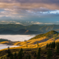
Trails on the Mountain Home Ridge property joined Leavenworth’s quiver of options in 2008 when the Trust for Public Lands, which provided funding, and the CDLT worked together to preserve this 169-acre parcel bordering Mountain Home Road. The area had burned during the 1994 Rat Creek Fire and while it lacked the iconic look that people associate with pristine forests, the property’s recovery from fire provided forbs, shrubbery, snags, and space important for the feed and movement of elk, deer, bear, coyotes and birds. CDLT has been successfully applying forest health treatments since it purchased the property to help the forest recover, and residents can expect some prescribed burning to reduce hazardous fuels there this fall.
Starting at a higher elevation than most other Leavenworth trails, the Mountain Home Ridge trails have also become important to outdoor enthusiasts. In spring, the flower season lingers along the property’s paths when the bloomers at town level have burned off. And this time of year, when the summer sun sends the mercury rocketing, these trails offer cooler air and the shade of a northwestern exposure for a more enjoyable summer escape.
Details – Visiting Mountain Home Ridge
Access: From Highway 2 at the east end of Leavenworth, turn south onto East Leavenworth Road. In 150 yards turn left onto Mountain Home Road and check the odometer. In 3.4 miles (about one mile past the Mountain Home Lodge), park in the large pullout on the right. Currently, the PortaPotty in the pullout helps mark the spot.
Trip Instructions: Entrance to the property is along the dirt road on the opposite side of the road from the pullout.
Map: See the attached CalTopo map. A map is also available in the www.WenatcheeOutdoors.org guidebooks covering Mountain Home Ridge.
Trip Stats: About 4.9 miles roundtrip and 700 vertical-foot gain if turning around at the intersection with FS Road 7300-500; 7.1 miles round trip and 1150-foot gain if summiting Boundary Butte.
Land Ownership: This outing uses a combination of Land Trust and Forest Service properties.
Allowed: Hiking, mountain biking, trail running, birding, equestrian use, dogs (scoop their poop).
Not Allowed: No motorized vehicles, off-trail travel, hunting, shooting, littering, camping, or campfires. Strive to leave the area better than you found it.
Special Note: Forest Service personnel have been severely pruned by the current administration and many trails that outdoor enthusiasts enjoy won’t see regular maintenance in the years ahead. Part of this hike spans Forest Service property and, here, shrubbery is already encroaching on the trail. Visitors might consider carrying hedge shears or loppers on outings like this -- many people contributing a little love to our trails will help keep them walkable.
Upcoming Events: Join Chelan-Douglas Land Trust and Columbia Valley Community Health for the September Hike for Health on Saturday, September 13, 9–11 AM at Cashmere Canyons Preserve. This 3-mile guided walk (762 ft. gain) will explore local plants, wildlife, and history and will be offered in both English and Spanish. All ages are welcome, and all participants will be entered into a raffle for a chance to win a health-focused prize!
Andy Dappen is the founder of the WenatcheeOutdoors.org website and a former board member of the Chelan-Douglas Land Trust. He hopes people using Land Trust properties will join the organization ($50/year, https://www.cdlandtrust.org/support-us/donate).
Forty for Forty. Recognizing the 40th Anniversary of the Chelan-Douglas Land Trust with 40 stories about places the CDLT has protected and kept open for public access.
Online Resource

Trail maps, directions, more info

40 Years of Conservation Success
